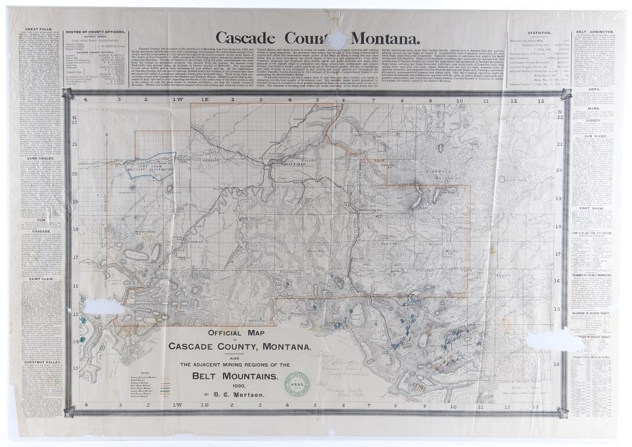
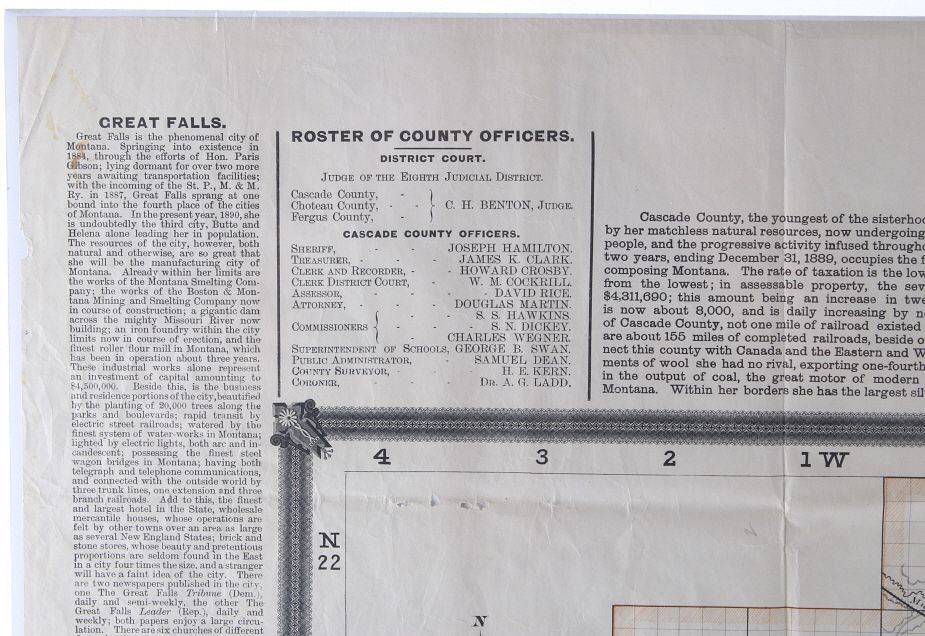
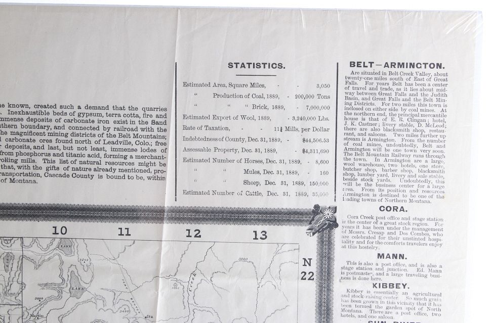
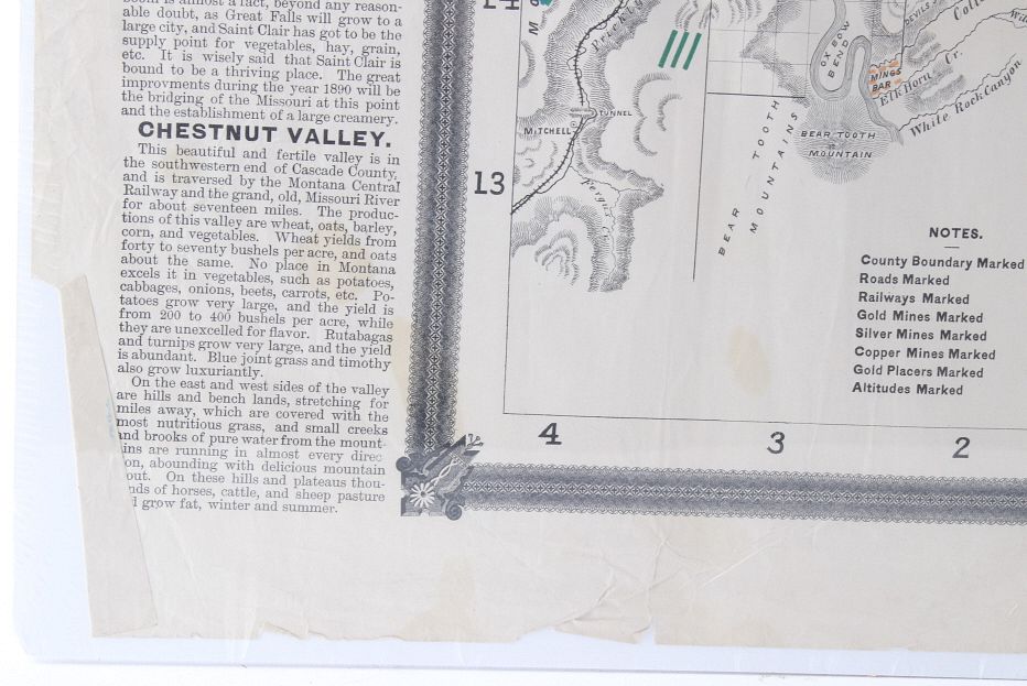
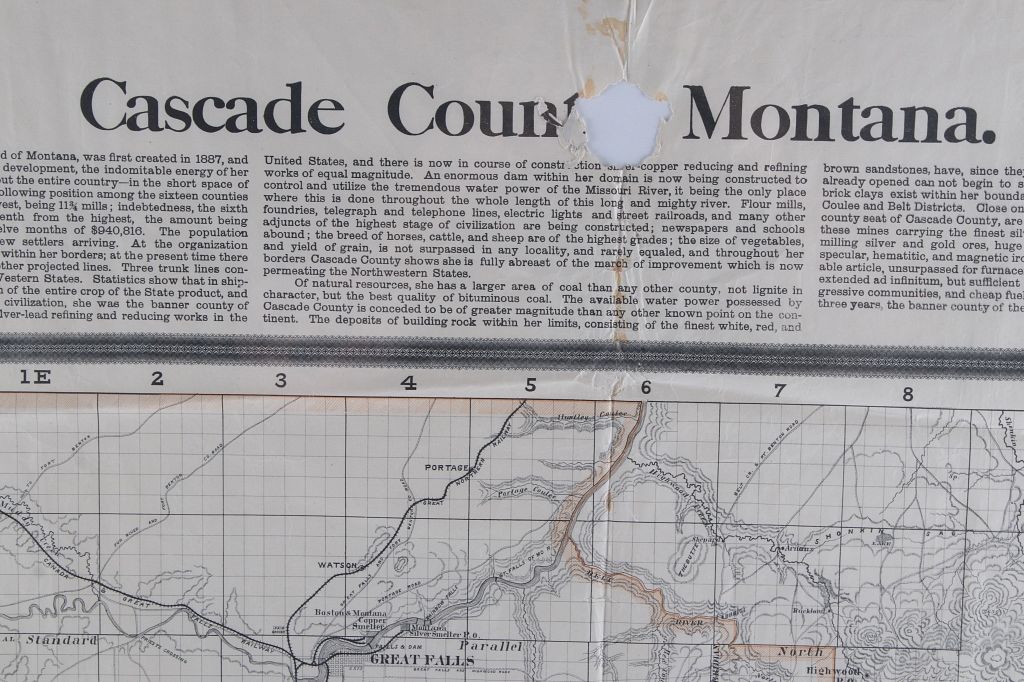
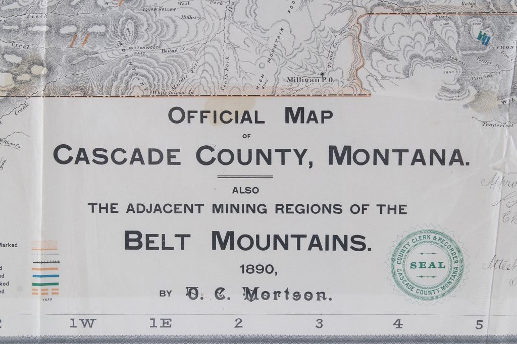
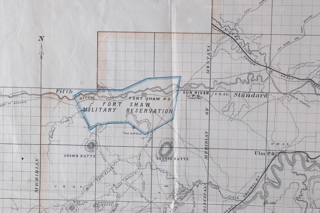
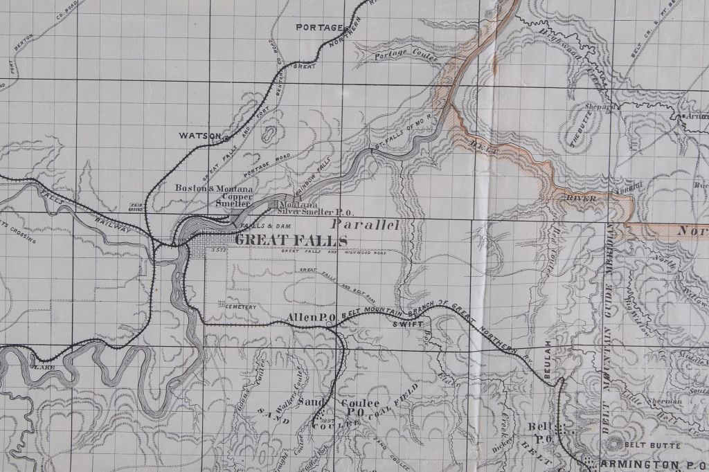
Fine Montana Collector Sale - April 2023
Sat, Apr 22, 2023 11:00AM EDT

| Price | Bid Increment |
|---|---|
| $50 | $10 |
| $100 | $25 |
| $500 | $50 |
| $1,000 | $100 |
| $2,000 | $250 |
| $5,000 | $500 |
| $10,000 | $1,000 |
| $50,000 | $2,500 |
North American Auction Company is proud to announce the opening of our new in-house, full-service shipping department. We have listened to you the customer and will now be handling all outgoing packages in our new shipping department. We are confident this new offering will allow for a smooth transition from auction block to your front step. We have partnered with preferred carriers to ensure a safe, efficient delivery that works best with your schedule. Please allow 14-21 days after complete invoice payment is made to package and ship your purchase. After you are notified of your winning bids from our company and your item invoice is paid in full our new shipping department will contact you. Make sure when signing up with our company that your preferred shipping information is up to date as this information will be used to estimate shipping cost. Once the items have been packaged our team will contact you for shipping payment. Shipping invoices and payment will be completely separately than the items invoice. Please notify the shipping department with any alternate request or instructions at mark@northamericanauctioncompany.com or 800-686-4216 ext. 3. For a shipping quote please contact the same information above. PLEASE NOTE a shipping quote price can fluctuate in price. Auction company is not responsible for actual shipping cost being higher than quoted shipping cost. Thank you for trusting North American Auction Co. with your bids and shipping. As our shipping department is brand new please understand that delays can be expected.