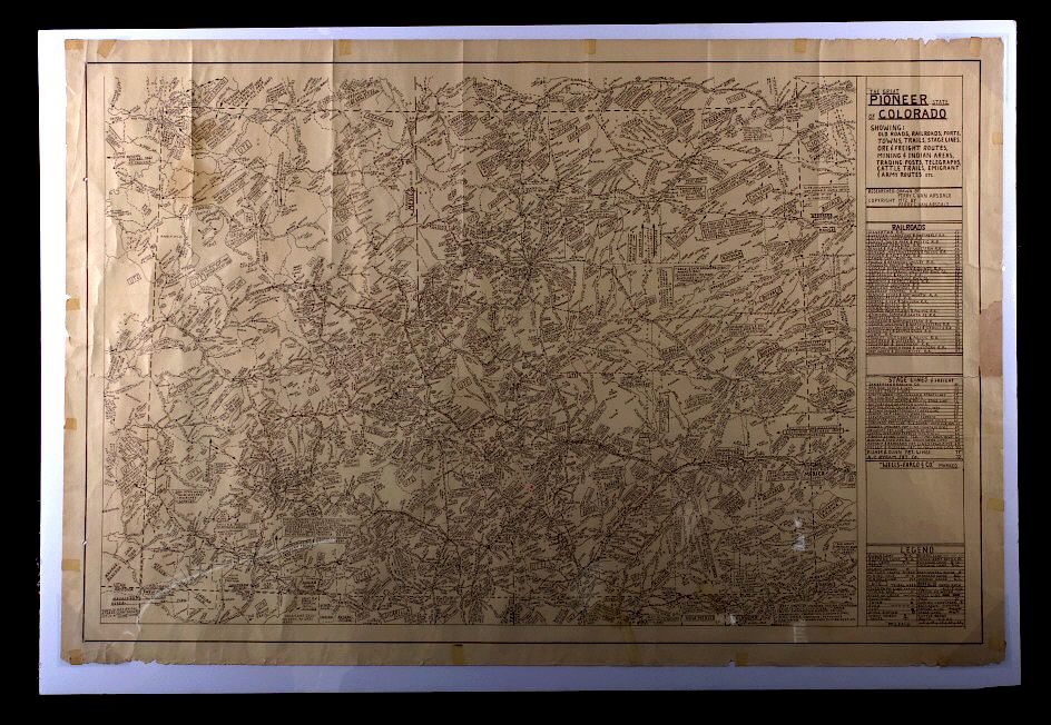
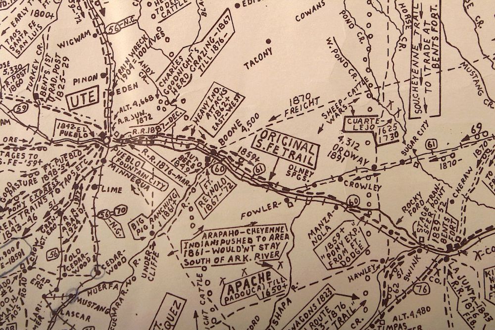
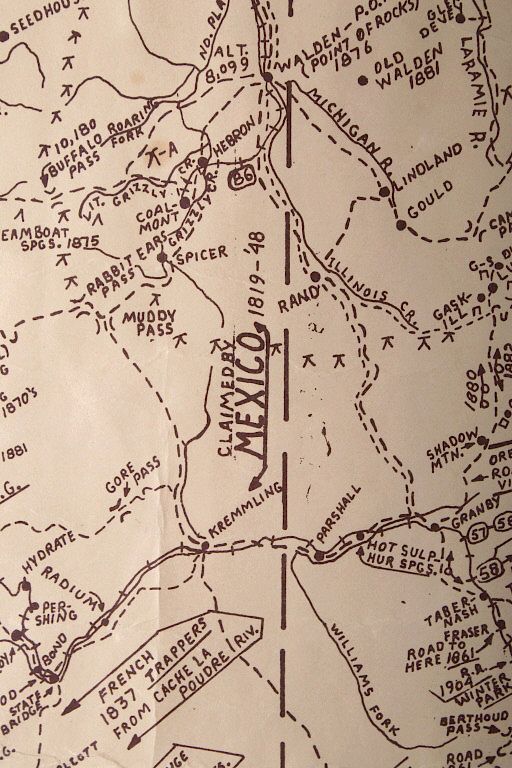
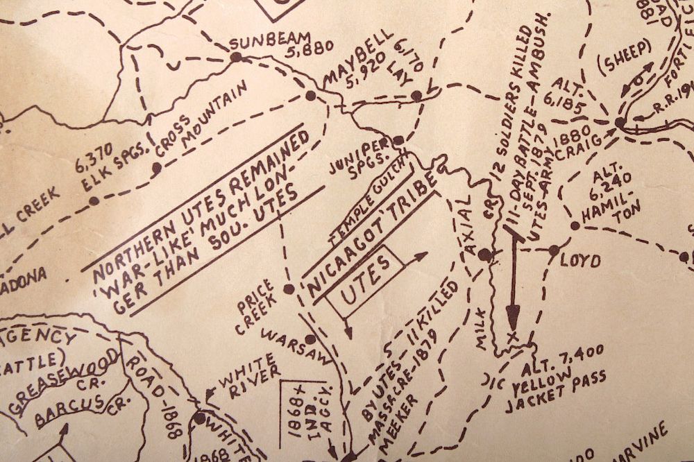
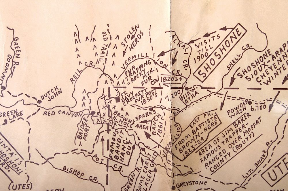
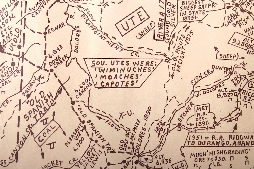
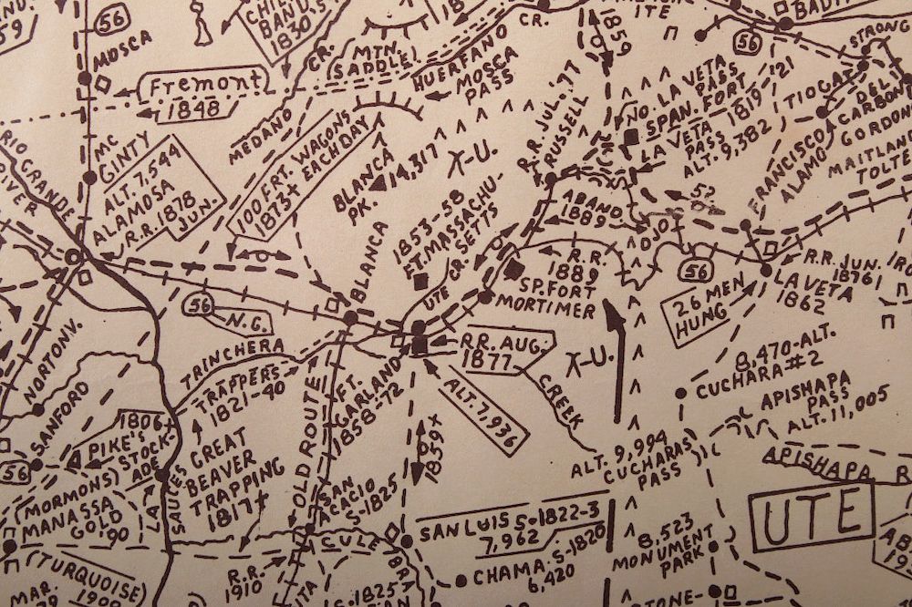
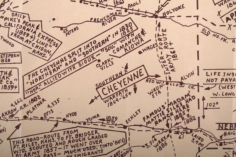
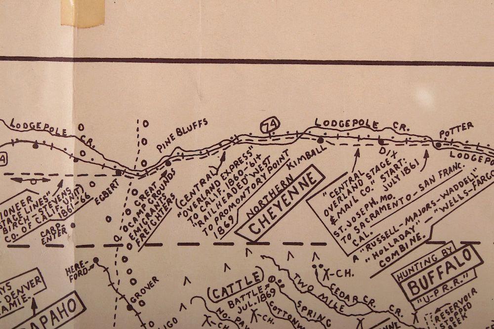
This lot introduced for your consideration is The Great Pioneer State of Colorado Map. The great pioneer state of Colorado: showing old roads, railroads, forts, towns, trails, stage lines, ore & freight routes, mining & Indian areas, trading posts, telegraphs, cattle trails, emigrant & army routes, etc. is researched and drawn by Perry C Van Arsdale; and copyrighted in 1972. This map depicts 19th century territory now known as Colorado. It has markers for various Indian tribes ranging from the Ute Indians both North and South, to Comanche and Nicaagut Indians. Also transcribed are the Santa Fe trail and South Cheyenne trails among others. Some forts to note are Fort Massachusetts, Bent's Fort, and Ft Davy Crockett. The Union Pacific Railroad steamed through this landscape as well as the Rio Junction Railroad. This map is in good condition preserved in a plastic sleeve and backed by a sturdy white presentation. This map has some worn edges and age marks. Measurements for this piece are 28" x 41.75"; measurements including white presentation are 29.75" x 43.5".
Condition
For a complete representation of condition and for additional images please call 800-686-4216. It is the buyer’s responsibility to view each image and preview the item to determine condition.