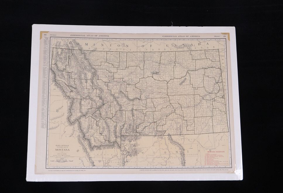
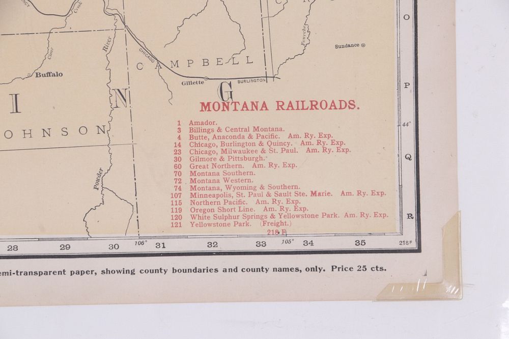
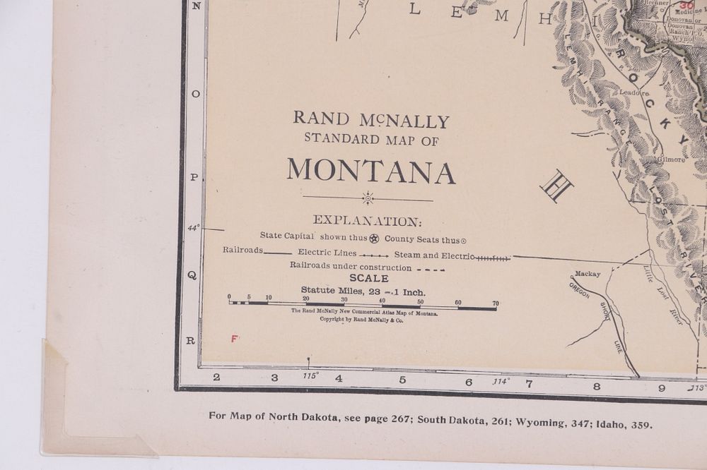
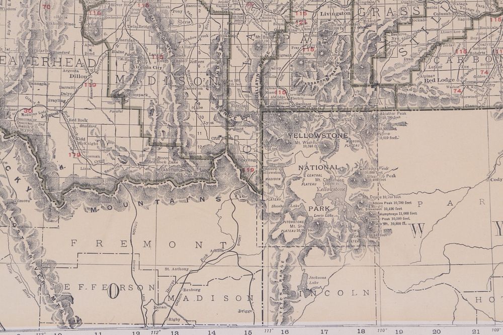
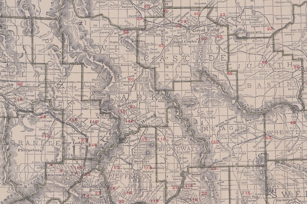
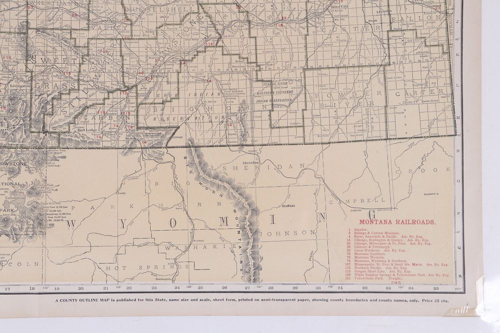
For your consideration is a Rand McNally Standard Map of Montana from the Rand McNally & Company, Chicago, circa 1920. The map shows Montana split by green county lines with railroads marked across the piece. The map features railroads such as; Amador, Billings & Central Montana, Butte, Anaconda & Pacific., Oregon Short Line, Montana Southern / Western/ Wyoming & Southern, Yellowstone Park (freight) and more. The map shows the entire state lines with British Colombia to the north, North Dakota to the east, Wyoming to the south, and Idaho to the west. The map shows detailed geography with numerous rivers and mountain ranges with elevations marked across the piece. Left of the map is a list of Principal Cities with populations and alpha-numeric locations on the map. This is a wonderful and impressive map that would make a great addition to any collection. The map shows good condition overall, and is protected with a foam board back and shrink, as well as corner protectors on the map. This piece measures approximately 20.5 x 28".